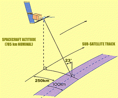
IMAGING SENSORS FEATURED

ERS -1,2 SAR
ENVISAT ASAR
ENVISAT MERIS
TERRA/AQUA MODIS


I. ERS-1, ERS-2 SAR

European Remote Sensing Satellite (ERS-1) was launched on 17 July 1991, and the follow mission ERS-2 (with the same sensors and an Ozone monitoring instrument added) was launched on 21 April 1995.

ERS-1 and ERS-2 satellites are in similar orbits.

The ERS-1 mission is split in several phases with different repeat cycles, optimized for different applications.

ERS-2 has a fixed repeat cycle of 35 days, and follows ERS-1 tracks with one day's delay.

AMI-SAR (Active Microwave Imager in Synthetic Aperture Radar) operates at C- band (5.3 GHz, 5.6 cm), 15.55 MHz bandwidth, VV-polarization, pulse repetition frequency 1640-1720 Hz, transmitted pulse length 64ns (compressed), transmitted peak power 4.8 kW. The physical antenna size is 10m x 1m. The incidence angle on the horizontal Earth surface at mid swath is 23° (ranging from 19° at near range to 26° at far range). Swath width is 102.5 km (telemetered), spatial resolution is about 25x25 m.


II. Envisat ASAR

The Advanced SAR (ASAR) instrument is carried by ESA's ENVISAT satellite launched on 1 March 2002. The ASAR, operated at C-band (5.331 GHz), can be regarded as an advanced version of the SAR instruments on board the ERS-1 and ERS-2 satellites. Its beam elevation steerage allow the selection of different swaths at different incidence angles, providing a swath coverage of over 400-km wide using ScanSAR techniques. In alternating polarizations mode, transmit and receive polarizations can be selected allowing scenes to be imaged simultaneously in two polarizations.

In the image mode, ASAR operates in one of seven predetermined swaths (100 km swath width) with either vertically or horizontally polarized radiation; the same polarization is used for transmit and receive (i.e., HH or VV). The ground resolution is about 30 m (three looks), sampled at pixel separation of 12.5 m.

In the alternating polarization mode (in one of seven possible swaths), two images in two polarization modes (HH & VV, or HH & HV, or VV & VH) are acquired. The ground resolution is about 30 m (1.8 equivalent number of looks), sampled at 12.5 m spacing.

When operating in the ScanSAR mode, a wide swath of > 400 km can be achieved, at a ground resolution of about 150 m (11.5 equivalent number of looks), sampled at 75 m pixel spacing.


III. Terra/Aqua MODIS

MODIS (Moderate-resolution Imaging Spectroradiometer) is a payload scientific instrument launched into Earth orbit by NASA in 1999 on board the Terra (EOS AM) Satellite, and in 2002 on board the Aqua (EOS PM) satellite. The instruments capture data in 36 spectral bands ranging in wavelength from 0.4 µm to 14.4 µm and at varying spatial resolutions (2 bands at 250 m, 5 bands at 500 m and 29 bands at 1 km). Together the instruments image the entire Earth every 1 to 2 days. They are designed to provide measurements in large-scale global dynamics including changes in Earth's cloud cover, radiation budget and processes occurring in the oceans, on land, and in the lower atmosphere.

SPECIFICATIONS
Orbit 705 km, 10:30 a.m. descending node (Terra) or 1:30 p.m. ascending node (Aqua), sun-synchronous, near-polar, circular
Scan Rate 20.3 rpm, cross track
Swath 2330 km (cross track) by 10 km (along track at nadir)

DIMENSIONS
Telescope 17.78 cm diam. off-axis, afocal (collimated), with intermediate field stop
Spatial Resolution 250 m (bands 1-2) 500 m (bands 3-7) 1000 m (bands 8-36)
Design Life 6 years

IV. Envisat MERIS

MEdium Resolution Imaging Spectrometer (MERIS) is composed of five cameras disposed side by side, each equipped with a pushbroom spectrometer. These spectrometers use two-dimensional CCDs. One of the sides of the detector is oriented perpendicular to the trajectory of the satellite and simultaneously collects, through the front optics, observations for a line of points at the Earth's surface (or in the atmosphere). The displacement of the platform along its orbit, combined with a short integration time, generate data that can later be used to create two-dimensional images. A light dispersing system separates the various wavelengths (colors) composing the incoming radiation at the entrance of the instrument and directs these on the detector along the second dimension, i.e., along track. These spectrometers acquire data in a large number of spectral bands, but, for technical reasons, only 16 of them are actually transmitted to the ground segment (one of which is required for the low-level processing of the raw data). This instrument thus provides useful data in 15 spectral bands, which are actually programmable in position, swath and gain. In practice, these technical characteristics are kept constant most of the time to allow a large number of systematic or operational missions. The intrinsic spatial resolution of the detectors provides for samples every 300 m near nadir at the Earth's surface, and the pushbroom design avoids or minimizes the distortions (e.g., bow tie effects) typical of scanning instruments. This is known as the 'Full Resolution (FR)' product. The more common 'Reduced Resolution (RR)' products are generated by aggregating the FR data to a nominal resolution of 1200 m. The total field of view of MERIS is 68.5 degrees around nadir (yielding a swath of 1150 km), which is sufficient to collect data for the entire planet every 3 days (in equatorial regions). Polar regions are visited more frequently due to the convergence of orbits.

Home